2010
NZ2664 : Lead Works Ruin
taken 13 years ago, near to Byker, Newcastle Upon Tyne, England
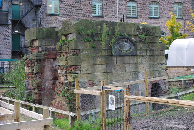
Lead Works Ruin
This sandstone ruin is one of the many reminders of the Ouseburn's harsh industrial past. It once housed a steam engine that drove the spinning machines of a nineteenth century flax mill. In 1871 the site was taken over by the Northumberland Lead works and the engine was used to power heavy grinders that crushed white lead into a fine powder. White lead is toxic but once a common pigment in paint and varnish.
 Map © Crown Copyright")
TIP: Click the map for more Large scale mapping
- Grid Square
- NZ2664, 484 images (more nearby 🔍)
- Photographer
- peter maddison (more nearby)
- Date Taken
- Tuesday, 9 November, 2010 (more nearby)
- Submitted
- Tuesday, 9 November, 2010
- Subject Location
-
OSGB36:
 NZ 262 645 [100m precision]
WGS84: 54:58.5087N 1:35.4676W - Camera Location
-
OSGB36: NZ 262 645
- View Direction
- West-southwest (about 247 degrees)