2010
TM2690 : 498th Bomb Group Museum at Hardwick Airfield
taken 13 years ago, near to Topcroft Street, Norfolk, England
This is 1 of 3 images, with title 498th Bomb Group Museum at Hardwick Airfield in this square
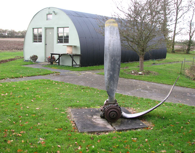
498th Bomb Group Museum at Hardwick Airfield
During WWII the 489th Bombardment Group was stationed at nearby RAF Halesworth. When the Friends of the 489th were unable to find suitable premises, in 1995 they were generously offered the use of former WWII Nissen huts, situated on farmland on the site of the former WWII airfield at Hardwick, belonging to the Woodrow family. The museum opened in 1996 and work has continued over the years to improve the display of the exhibits. The museum is open (on every 3rd Saturday) from May to October. See also: Link
Update - June 2014: The 489th BG artefacts have been returned to Halesworth where they are currently housed in the RAF Halesworth Memorial Museum in Upper Holton. The Hardwick Airfield Museum is now called 93rd Bomb Group Museum.
The base at Hardwick was opened in December 1942, and the 93rd Bombardment (H) Group had settled in by February 1943.The group was part of the 20th Combat Wing of the 2nd Air Division of the 8th Air Force and the first B-24 Unit in Europe, arriving in September 1942. The airfield has long since been returned to agriculture and only part of one runway still remains. The main buildings such as the control tower are long gone but on the surrounding farms a number of dispersed buildings are still in (farm) use.
 Map © Crown Copyright")
TIP: Click the map for more Large scale mapping
- Grid Square
- TM2690, 111 images (more nearby 🔍)
- Photographer
- Evelyn Simak (more nearby)
- Date Taken
- Wednesday, 10 November, 2010 (more nearby)
- Submitted
- Wednesday, 10 November, 2010
- Subject Location
-
OSGB36:
 TM 264 908 [100m precision]
WGS84: 52:28.0932N 1:19.9727E - Camera Location
-
OSGB36: TM 265 908
- View Direction
- WEST (about 270 degrees)