2010
NS3776 : Farm track
taken 13 years ago, near to Renton, West Dunbartonshire, Scotland
This is 1 of 8 images, with title Farm track in this square
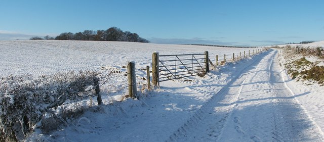
Farm track
This track (see NS3776 : Farm track) leads between the fields of Whiteleys Farm. The distant trees on the left form a square block of woodland that is called NS3776 : Perrays Wood.
For a view along the same section of track in the opposite direction, see NS3776 : Farm track.
For a view along the same section of track in the opposite direction, see NS3776 : Farm track.
 Map © Crown Copyright")
TIP: Click the map for more Large scale mapping
- Grid Square
- NS3776, 67 images (more nearby 🔍)
- Photographer
- Lairich Rig (more nearby)
- Date Taken
- Friday, 24 December, 2010 (more nearby)
- Submitted
- Thursday, 6 January, 2011
- Subject Location
-
OSGB36:
 NS 3776 7662 [10m precision]
WGS84: 55:57.3074N 4:36.0098W - Camera Location
-
OSGB36: NS 3776 7665
- View Direction
- SOUTH (about 180 degrees)