2010
SJ8861 : Bridge on the Biddulph Valley Way
taken 13 years ago, near to Hightown, Cheshire East, England
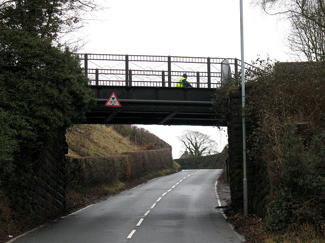
Bridge on the Biddulph Valley Way
This bridge originally carried the Biddulph Valley Railway (1859 to 1968). It is now a recreational route as can be seen by the cyclist crossing the bridge.
The height of the bridge over Reade's Lane is 12 feet (unusually nowadays, the metric equivalent is not given).
For a view on top of the bridge see SJ8861 : Higher Dane in Shaw Bridge.
The height of the bridge over Reade's Lane is 12 feet (unusually nowadays, the metric equivalent is not given).
For a view on top of the bridge see SJ8861 : Higher Dane in Shaw Bridge.
 Map © Crown Copyright")
TIP: Click the map for more Large scale mapping
- Grid Square
- SJ8861, 41 images (more nearby 🔍)
- Photographer
- Stephen Craven (more nearby)
- Date Taken
- Thursday, 30 December, 2010 (more nearby)
- Submitted
- Saturday, 8 January, 2011
- Subject Location
-
OSGB36:
 SJ 8843 6167 [10m precision]
WGS84: 53:9.1223N 2:10.4676W - Camera Location
-
OSGB36: SJ 8838 6167
- View Direction
- EAST (about 90 degrees)