2011
NZ1553 : Junction of bridleways and footpaths at Stob House
taken 13 years ago, near to Dipton, County Durham, England
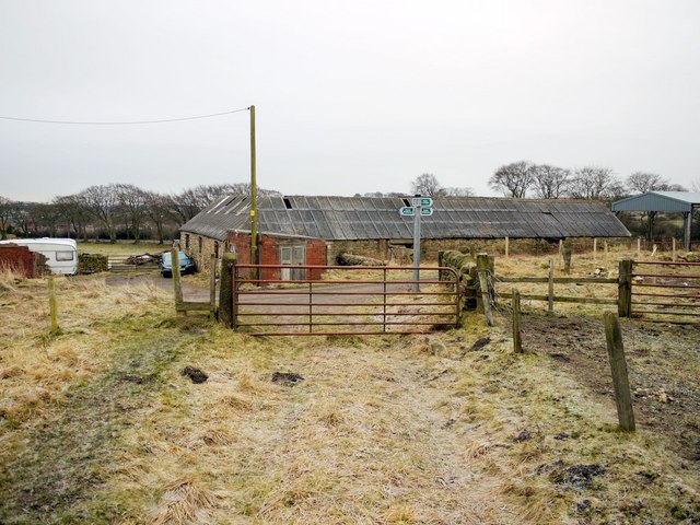
Junction of bridleways and footpaths at Stob House
The main track running left to right after the gate is the old Stob Waggonway that was part of an extensive system of wooden railed waggonways in the area which served the many coal pits.
 Map © Crown Copyright")
TIP: Click the map for more Large scale mapping
- Grid Square
- NZ1553, 73 images (more nearby 🔍)
- Photographer
- Andrew Curtis (more nearby)
- Date Taken
- Friday, 7 January, 2011 (more nearby)
- Submitted
- Tuesday, 25 January, 2011
- Subject Location
-
OSGB36:
 NZ 1588 5326 [10m precision]
WGS84: 54:52.4315N 1:45.2438W - Camera Location
-
OSGB36: NZ 1588 5329
- View Direction
- SOUTH (about 180 degrees)