2006
SH7478 : Cycle track round Penmaenbach Point
taken 18 years ago, near to Capelulo, Conwy, Wales
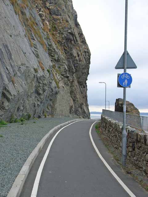
Cycle track round Penmaenbach Point
The headland at Penmaenbach forms a formidable barrier to communication along the north Wales coast. In the days of horse and cart, carriages had to be dismantled to carry them round the headland! Nowadays, things are a little bit easier as the main A55 North Wales Expressway is carried through the headlands in tunnels. Unlike the Pen-y-Clip tunnels a short way to the west, a good cycle and pedestrian path runs alongside the road round the outside of this headland, approximately along the line of the old (pre-tunnel) road.
 Map © Crown Copyright")
TIP: Click the map for more Large scale mapping
- Grid Square
- SH7478, 96 images (more nearby 🔍)
- Photographer
- Oliver Dixon (more nearby)
- Date Taken
- Wednesday, 23 August, 2006 (more nearby)
- Submitted
- Sunday, 27 August, 2006
- Subject Location
-
OSGB36:
 SH 746 785 [100m precision]
WGS84: 53:17.3151N 3:52.9579W - Camera Location
-
OSGB36: SH 746 785
- View Direction
- West-southwest (about 247 degrees)