SK4963 : Former Railway Cutting
taken 13 years ago, near to Pleasley, Derbyshire, England
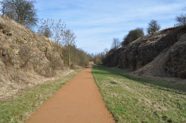
The Pleasley Colliery site is the centre of a major leisure development including landscaping of the former pit spoil heap as an important nature and walking area, and creation of a network of trails largely using former railway alignments. The railways involved were the competing local branches of the Midland and Great Northern Railways. They appear to be typical of the lines which disappeared under the Beeching reforms, but in fact had a very different history. Both lines lost their passenger services early - in 1930 and 1931 respectively, but then remained open to a greater or lesser extent until the end of coal production in the region in the 1980s. The southerly of the two lines (GNR) now supports the Skegby Trail between Pleasley, Skegby and Sutton-in-Ashfield. The northerly (MR) splits to form the relatively short Rowthorne Trail and the longer Teversal Trail which itself links to further old railway trails towards Alfreton and Chesterfield. Interesting, neither the Skegby nor Teversal Trails have formal right-of way status, although the Rowthorne Trail does. The former are mainly in Nottinghamshire, while the latter is in Derbyshire.
 Map © Crown Copyright")
- Grid Square
- SK4963, 63 images (more nearby 🔍)
- Photographer
- Ashley Dace (more nearby)
- Date Taken
- Thursday, 24 February, 2011 (more nearby)
- Submitted
- Friday, 25 February, 2011
- Subject Location
-
OSGB36:
 SK 495 637 [100m precision]
WGS84: 53:10.1251N 1:15.6505W - Camera Location
-
OSGB36: SK 494 637
- View Direction
- Northeast (about 45 degrees)