2004
SE5928 : Burn, Methodist Church
taken 20 years ago, near to Burn, North Yorkshire, England
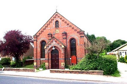
Burn, Methodist Church
This small Church lies just to the north of centre of the O/S grid it occupies, on the western side of the A19 in the centre of the village.
 Map © Crown Copyright")
TIP: Click the map for more Large scale mapping
- Grid Square
- SE5928, 31 images (more nearby 🔍)
- Photographer
- Bill Henderson (more nearby)
- Date Taken
- 2004 (more nearby)
- Submitted
- Friday, 1 September, 2006
- Subject Location
-
OSGB36:
 SE 59 28 [1000m precision]
WGS84: 53:44.9690N 1:5.9516W