SK8199 : Pumping stations at Owston Ferry
taken 13 years ago, near to East Ferry, Lincolnshire, England
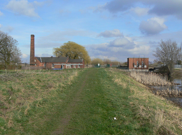
On the right is the Warping Drain. This is a catchwater or highwater drain, draining from the area around Finningley, at some distance from the River Trent. As such it is classed for drainage purposes as a 'main river' and is controlled by the Environment Agency rather than by a local Drainage Board. Although not immediately apparent in this picture there is a considerable difference in the water level of the two drains, of the order of 3-4 metres.
The pumping station was built by the Isle of Axholme Drainage Board in 1910 when it was found that the existing gravity sluices were no longer able to cope with the volume of water, especially with a general lowering of water levels. The Drainage Board traces its history back to the original drainage schemes created by the Dutch engineer Vermuyden in the 1620s.
The initial installation consisted of two tandem compound steam engines by Marshalls of Gainsborough driving Drysdale centrifugal pumps. These were supplied with steam by two Cornish type boilers, also built by Marshalls.
In 1946 a diesel pump was installed to cope with a further lowering of the water level, although the steam pumps remained in use. In the early 1950s one of the steam engines was replaced by a Ruston & Hornsby 2-cylinder diesel which continued to drive the Drysdale pump. The second steam engine was taken out of use in the 1960s.
The Marshall and Ruston pumping sets together with the boilers are now in the care of the Owston Ferry Pumping Station Preservation Society. The engines and pumps remain in working conditions although the boilers are beyond economic repair.
 Map © Crown Copyright")
- Grid Square
- SK8199, 102 images (more nearby 🔍)
- Photographer
- Alan Murray-Rust (more nearby)
- Date Taken
- Sunday, 13 March, 2011 (more nearby)
- Submitted
- Thursday, 17 March, 2011
- Subject Location
-
OSGB36:
 SK 813 994 [100m precision]
WGS84: 53:29.1296N 0:46.5571W - Camera Location
-
OSGB36: SK 811 994
- View Direction
- East-northeast (about 67 degrees)