2011
SW6536 : Bridle path north west of the reservoir
taken 13 years ago, near to Troon, Cornwall, England
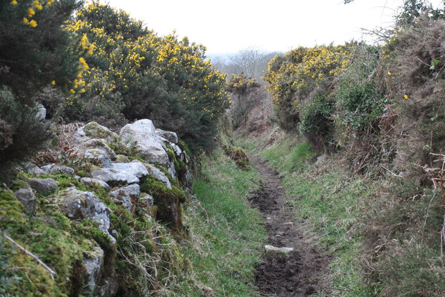
Bridle path north west of the reservoir
Just north west of the reservoir the bridle path goes between gorse-covered hedges or walls. It descends towards Carwynnen.
 Map © Crown Copyright")
TIP: Click the map for more Large scale mapping
- Grid Square
- SW6536, 32 images (more nearby 🔍)
- Photographer
- Elizabeth Scott (more nearby)
- Date Taken
- Sunday, 20 March, 2011 (more nearby)
- Submitted
- Sunday, 20 March, 2011
- Subject Location
-
OSGB36:
 SW 656 364 [100m precision]
WGS84: 50:10.8812N 5:17.0183W - Camera Location
-
OSGB36: SW 657 364
- View Direction
- West-northwest (about 292 degrees)