2011
NT2573 : Tenements, Royal Mile
taken 13 years ago, near to Edinburgh, Scotland
This is 1 of 3 images, with title Tenements, Royal Mile in this square
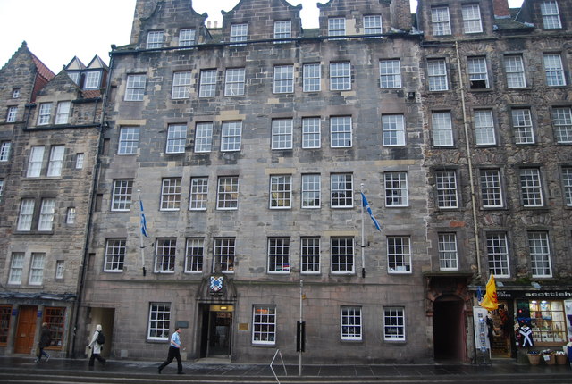
Tenements, Royal Mile
Circa 1700, Grade II listed. Link
The Royal Mile :: NT2673
The Royal Mile is 1 Scottish Mile long (1.1 imperial miles). It is a number of streets that lead down from Edinburgh Castle to Holyrood Palace. The royal mile is the heart of Edinburgh Old Town and contains many of the city's important buildings. The mile follows the "tail" of the Edinburgh Crag and tail a feature created by glacial erosion.
Wikipedia: Link
 Map © Crown Copyright")
TIP: Click the map for more Large scale mapping
- Grid Square
- NT2573, 6124 images (more nearby 🔍)
- Photographer
- N Chadwick (more nearby)
- Date Taken
- Tuesday, 22 February, 2011 (more nearby)
- Submitted
- Sunday, 20 March, 2011
- Subject Location
-
OSGB36:
 NT 255 735 [100m precision]
WGS84: 55:56.9464N 3:11.6047W - Camera Location
-
OSGB36: NT 255 735
- View Direction
- South-southeast (about 157 degrees)