2011
SX4266 : End of the path
taken 13 years ago, near to Bohetherick, Cornwall, England
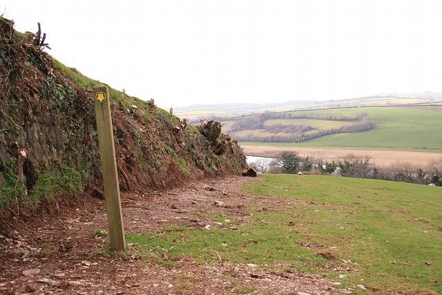
End of the path
Oddly, Bere Ferrers public footpath 96 terminates here, halfway down the field, with not unattractive views north and west, over the River Tamar. But quite how it came about like this is a mystery. The highway authority has helpfully put up a waymark on a post to show where the path stops - though unhelpfully, the only indication that the walker has reached the path's terminus is that the waymark points down, rather than up and ahead.
 Map © Crown Copyright")
TIP: Click the map for more Large scale mapping
- Grid Square
- SX4266, 29 images (more nearby 🔍)
- Photographer
- Hugh Craddock (more nearby)
- Date Taken
- Sunday, 6 March, 2011 (more nearby)
- Submitted
- Monday, 4 April, 2011
- Subject Location
-
OSGB36:
 SX 4296 6621 [10m precision]
WGS84: 50:28.4772N 4:12.8702W - Camera Location
-
OSGB36: SX 4299 6621
- View Direction
- WEST (about 270 degrees)