1992
J3474 : Weir and cross-harbour bridges, Belfast (35)
taken 32 years ago, near to Belfast, Co Antrim, Northern Ireland
Weir and cross-harbour bridges, Belfast (35)
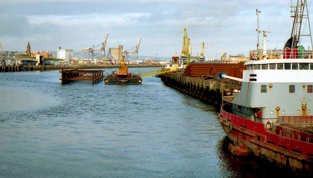
See J3474 : Weir and cross-harbour bridges, Belfast (34). The view from the Queen Elizabeth Bridge towards the site for the bridges. The dredger Hebble Sand is at Queens Quay. Continue to J3474 : Weir and cross-harbour bridges, Belfast (36).
Building the Lagan weir and cross-harbour bridges, Belfast
A collection of photographs showing the building of the Lagan weir and the cross-harbour road and railway bridges in the early 1990s. There are also some earlier shots of the pre-impounding River Lagan, of Donegall and Queens Quays, the Abercorn Basin and of the immediate area before demolition.
Loading map... (JavaScript required)
- Grid Square
- J3474, 4349 images (more nearby 🔍)
- Photographer
- Albert Bridge (more nearby)
- Date Taken
- Sunday, 16 February, 1992 (more nearby)
- Submitted
- Wednesday, 6 April, 2011
- Subject Location
-
Irish:
 J 345 746 [100m precision]
WGS84: 54:36.1458N 5:55.1295W - Camera Location
-
Irish: J 345 744
- View Direction
- NORTH (about 0 degrees)