2011
SD6613 : Brown Lowe from Coal Pit Lane
taken 13 years ago, 3 km from Belmont, Blackburn With Darwen, England
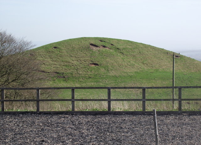
Brown Lowe from Coal Pit Lane
I have noticed that several (more or less) conically shaped hills in Lancashire are called "Lowe". I haven't been able to ascertain the derivation of the term.
 Map © Crown Copyright")
TIP: Click the map for more Large scale mapping
- Grid Square
- SD6613, 18 images (more nearby 🔍)
- Photographer
- philandju (more nearby)
- Date Taken
- Sunday, 10 April, 2011 (more nearby)
- Submitted
- Sunday, 10 April, 2011
- Subject Location
-
OSGB36:
 SD 669 130 [100m precision]
WGS84: 53:36.7607N 2:30.0802W - Camera Location
-
OSGB36: SD 667 131
- View Direction
- East-southeast (about 112 degrees)