2003
SO0319 : View of Upper Neuadd Reservoir from the Roman Road
taken 21 years ago, near to Tor Glas [other Features], Powys, Great Britain
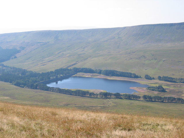
View of Upper Neuadd Reservoir from the Roman Road
 Map © Crown Copyright")
TIP: Click the map for more Large scale mapping
- Grid Square
- SO0319, 38 images (more nearby 🔍)
- Photographer
- John Thorn (more nearby)
- Date Taken
- Thursday, 4 September, 2003 (more nearby)
- Submitted
- Saturday, 9 September, 2006
- Subject Location
-
OSGB36:
 SO 034 194 [100m precision]
WGS84: 51:51.8873N 3:24.2581W - View Direction
- West-southwest (about 247 degrees)