2005
HY2627 : Stane Randa (Stanerandy on OS map)
taken 19 years ago, near to The Barony, Mainland, Orkney Islands, Scotland
This is 1 of 2 images, with title Stane Randa (Stanerandy on OS map) in this square
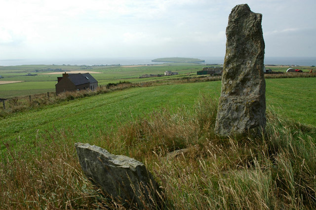
Stane Randa (Stanerandy on OS map)
There were two ancient stones standing 2 metres apart and of about 1.7 metres in height. One stone is now broken.
 Map © Crown Copyright")
TIP: Click the map for more Large scale mapping
- Grid Square
- HY2627, 6 images (more nearby 🔍)
- Photographer
- John Comloquoy (more nearby)
- Date Taken
- Thursday, 18 August, 2005 (more nearby)
- Submitted
- Sunday, 10 September, 2006
- Subject Location
-
OSGB36:
 HY 2675 2761 [10m precision]
WGS84: 59:7.7386N 3:16.8910W - Camera Location
-
OSGB36: HY 2675 2761
- View Direction
- West-northwest (about 292 degrees)