2006
SU2124 : The Pepperbox, Pepperbox Hill
taken 18 years ago, near to West Grimstead, Wiltshire, England
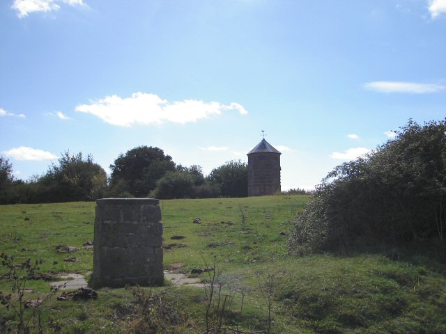
The Pepperbox, Pepperbox Hill
Built by Giles Eyre in 1606 to increase the height of his hill so that he could look down on his neighbours. The plinth in the foreground has a toposcope on the top of it.
 Map © Crown Copyright")
TIP: Click the map for more Large scale mapping
- Grid Square
- SU2124, 37 images (more nearby 🔍)
- Photographer
- Janine Forbes (more nearby)
- Date Taken
- Monday, 4 September, 2006 (more nearby)
- Submitted
- Monday, 11 September, 2006
- Subject Location
-
OSGB36:
 SU 2124 2486 [10m precision]
WGS84: 51:1.3634N 1:41.9124W - Camera Location
-
OSGB36: SU 2122 2494
- View Direction
- South-southeast (about 157 degrees)