2011
NG6523 : Housing in Harrapool
taken 13 years ago, near to Harrapool, Isle of Skye, Scotland
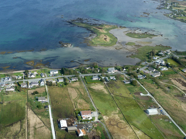
Housing in Harrapool
An aerial view. The main A87 crosses the view, with Broadford being to the left and Kyleakin and the Skye Bridge to the right. The roads joining it from the bottom of the picture are private driveways. The rectangular patches of land are individual crofts, these days often having more than one house on each. The low lying island is Glas Eilean.
Lochalsh and South Skye from the air
This is one of a series of images taken during a 35 minute helicopter pleasure flight starting and ending at Plockton Airfield. The trip covered some 60 miles, and flew over Kyle of Lochalsh, Broadford Bay, Luib, Loch Carron, Dornie and Plockton.
 Map © Crown Copyright")
TIP: Click the map for more Large scale mapping
- Grid Square
- NG6523, 32 images (more nearby 🔍)
- Photographer
- Richard Dorrell (more nearby)
- Date Taken
- Saturday, 23 April, 2011 (more nearby)
- Submitted
- Tuesday, 26 April, 2011
- Subject Location
-
OSGB36:
 NG 654 230 [100m precision]
WGS84: 57:14.2663N 5:53.3071W - Camera Location
-
OSGB36: NG 652 227
- View Direction
- Northeast (about 45 degrees)