2011
NM6950 : Rivers at south end of Loch Arienas
taken 13 years ago, near to Acharn, Highland, Scotland
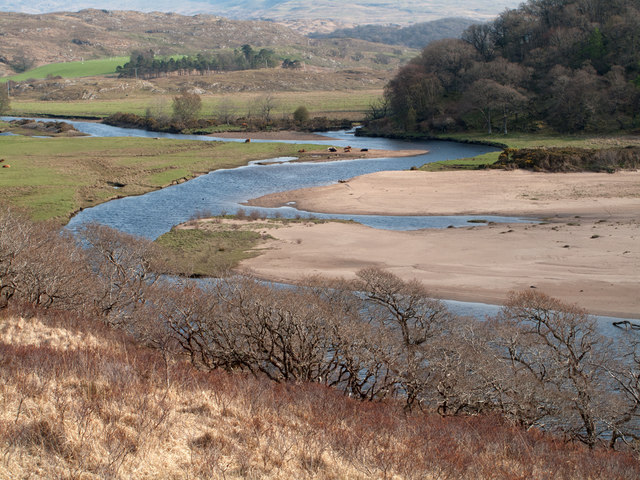
Rivers at south end of Loch Arienas
The Black Water enters the image from the left side but appears not to enter the loch; it merges with the River Aline leaving the loch and their combined waters then flow around the trees en route for The Sound of Mull via Loch Aline.
Note: the water level of Loch Arienas appears to be lower here than OS mapping suggests.
Note: the water level of Loch Arienas appears to be lower here than OS mapping suggests.
 Map © Crown Copyright")
TIP: Click the map for more Large scale mapping
- Grid Square
- NM6950, 25 images (more nearby 🔍)
- Photographer
- Trevor Littlewood (more nearby)
- Date Taken
- Monday, 18 April, 2011 (more nearby)
- Submitted
- Tuesday, 26 April, 2011
- Subject Location
-
OSGB36:
 NM 696 505 [100m precision]
WGS84: 56:35.4113N 5:45.2385W - Camera Location
-
OSGB36: NM 694 509
- View Direction
- South-southeast (about 157 degrees)