2011
SK5446 : Leen bridge at Moor Bridge
taken 13 years ago, near to Bestwood Village, Nottinghamshire, England
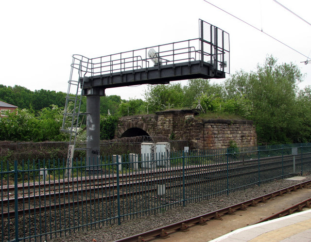
Leen bridge at Moor Bridge
Behind the chunky signal gantry on the Nottingham-Mansfield-Worksop Robin Hood Line are the remains of an old bridge which spans the River Leen and used to span the railway. It looks to date from the construction of the line by the Midland Railway in 1848 and may have been superseded when the newer Moor Bridge was built to the south, probably when the Bulwell Hall Estate was built. I should be glad to learn more about it. The nearer track is the NET tramway and the picture was taken from the platform of Moor Bridge tram stop. The green fence divides NET and railway property.
 Map © Crown Copyright")
TIP: Click the map for more Large scale mapping
- Grid Square
- SK5446, 77 images (more nearby 🔍)
- Photographer
- John Sutton (more nearby)
- Date Taken
- Friday, 6 May, 2011 (more nearby)
- Submitted
- Sunday, 8 May, 2011
- Subject Location
-
OSGB36:
 SK 546 466 [100m precision]
WGS84: 53:0.8407N 1:11.2034W - Camera Location
-
OSGB36: SK 546 466
- View Direction
- East-southeast (about 112 degrees)