TQ0430 : Wey and Arun Canal and Wey South Path
taken 13 years ago, near to Loxwood, West Sussex, England
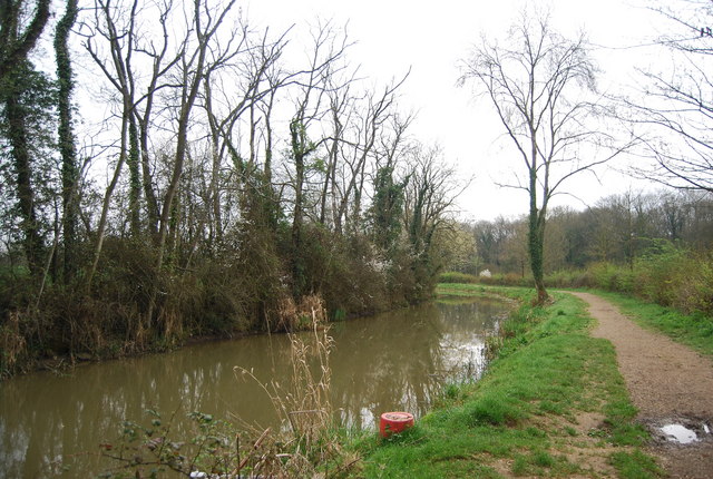
A 36 mile path from Millmead Lock, Guildford to Amberley in West Sussex. The Path follows the towpath of the Godalming Navigation along the River Wey to its confluence with the Wey & Arun Junction Canal, crossing the North Downs Way National Trail near the start. Wherever possible the route follows the towpath, supplemented by paths, roads and disused railway (Downs Link), to reach and continue beside the Arun Navigation to the River Arun whence the path continues to meet the South Downs Way National Trail above Amberley. Several sections of the canals have been restored. The canals were originally built for military purposes to provide a waterway linking the Thames and the south coast, but were soon supplanted by the railways and some sections fell into disrepair.
The Wey and Arun Canal is a 23-mile-long canal in the south of England, between the River Wey at Shalford, Surrey and the River Arun at Pallingham, in West Sussex.
Passing through a rural landscape, there was little freight traffic to justify its continued existence, and the canal was officially abandoned in 1871.
Without maintenance, the canal gradually became derelict over much of its length. However, since 1970, active restoration by The Wey & Arun Canal Trust has resulted in several miles of the waterway being restored to navigable standard. Work is continuing, with the ultimate aim of re-opening the entire canal to navigation.
Link
Part of the River Wey navigations. Link
 Map © Crown Copyright")
- Grid Square
- TQ0430, 72 images (more nearby 🔍)
- Photographer
- N Chadwick (more nearby)
- Date Taken
- Sunday, 3 April, 2011 (more nearby)
- Submitted
- Thursday, 12 May, 2011
- Subject Location
-
OSGB36:
 TQ 049 308 [100m precision]
WGS84: 51:4.0499N 0:30.2557W - Camera Location
-
OSGB36: TQ 048 308
- View Direction
- East-southeast (about 112 degrees)