2011
NG6225 : Forestry road
taken 13 years ago, near to Corry, Isle of Skye, Scotland
This is 1 of 5 images, with title starting with Forestry in this square
Forestry road
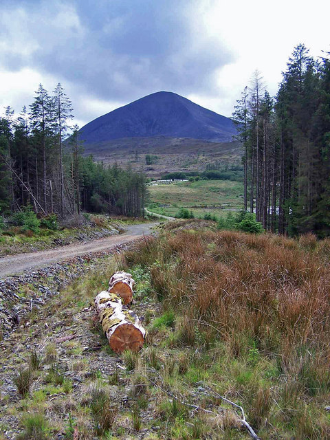
The nearest road was recently built to facilitate removal of felled timber from the forest. Now with forestry operations over, at least for the time being, the road provides pedestrian access to some fine views over Caolas Scalpay and Broadford Bay. Here, the view is inland, with Broadford cemetery just discernible roughly centrally, and the conical mound of Beinn na Caillich rising beyond.
 Map © Crown Copyright")
TIP: Click the map for more Large scale mapping
- Grid Square
- NG6225, 43 images (more nearby 🔍)
- Photographer
- Richard Dorrell (more nearby)
- Date Taken
- Saturday, 14 May, 2011 (more nearby)
- Submitted
- Sunday, 15 May, 2011
- Subject Location
-
OSGB36:
 NG 6282 2565 [10m precision]
WGS84: 57:15.5881N 5:56.0749W - Camera Location
-
OSGB36: NG 62943 25770
- View Direction
- Southwest (about 225 degrees)