2011
SO7348 : Archer's Mill, Cradley
taken 13 years ago, near to Stifford's Bridge, County of Herefordshire, England
This is 1 of 11 images, with title Archer's Mill, Cradley in this square
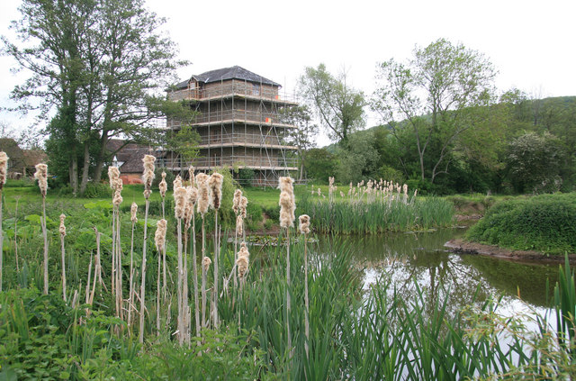
Archer's Mill, Cradley
Five storey watermill with a 17' breast shot wheel. Being restored and converted to an ayuverdic yoga and wellness centre. The mill was open as part of National Mills Weekend.
Mills Open Weekend 2011
National Mills Weekend is an annual celebration of the UK's milling heritage. The event is organised by the Mills Section of the Society for the Protection of Ancient Buildings.
The 2011 dates were the 14th and 15th May. Over 450 buildings were open to visitors meaning many to choose from. They ranged from fully working wind and water mills to under restoration or rarely open buildings.
 Map © Crown Copyright")
TIP: Click the map for more Large scale mapping
- Grid Square
- SO7348, 59 images (more nearby 🔍)
- Photographer
- Chris Allen (more nearby)
- Date Taken
- Sunday, 15 May, 2011 (more nearby)
- Submitted
- Sunday, 15 May, 2011
- Subject Location
-
OSGB36:
 SO 731 488 [100m precision]
WGS84: 52:8.2158N 2:23.6053W - Camera Location
-
OSGB36: SO 731 487
- View Direction
- NORTH (about 0 degrees)