2011
J3373 : Kensington Street, Belfast
taken 13 years ago, near to Belfast, Co Antrim, Northern Ireland
Kensington Street, Belfast
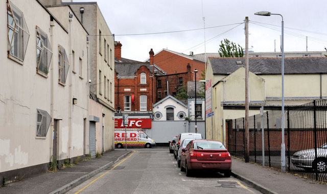
Kensington Street seems to have been built around the mid-19th century as a street of 47 houses running from the old Albion Street J3373 : Albion Street, Belfast to Wesley Place. Wesley Place, together with its westward continuation Blackstaff Lane, later became the Donegall Road. The name Wesley survives in the nearby Wesley Court J3373 : Wesley Court, Belfast. Todays Kensington Street runs from Stroud Street to the Donegall Road (background). The Google map shows it as Wesley Street. The real Wesley Street is the short (unnamed) street to the west. See also J3374 : Thomas Carnduff plaque, Belfast.
Loading map... (JavaScript required)
- Grid Square
- J3373, 2776 images (more nearby 🔍)
- Photographer
- Albert Bridge (more nearby)
- Date Taken
- Monday, 16 May, 2011 (more nearby)
- Submitted
- Tuesday, 17 May, 2011
- Subject Location
-
Irish:
 J 335 732 [100m precision]
WGS84: 54:35.3748N 5:56.0693W - Camera Location
-
Irish: J 335 732
- View Direction
- South-southeast (about 157 degrees)