2011
TM4698 : Sandy path through Herringfleet Hills
taken 13 years ago, near to Herringfleet, Suffolk, England
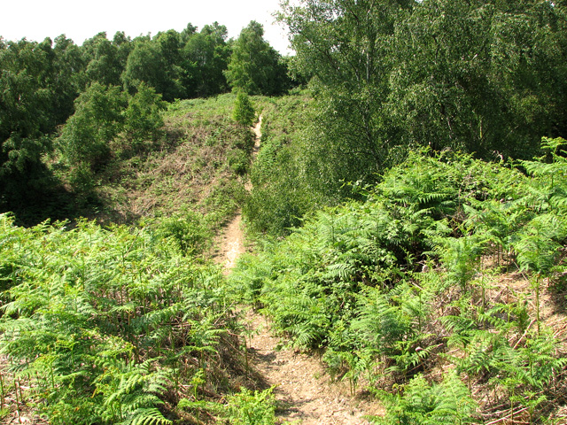
Sandy path through Herringfleet Hills
This area forms part of the Somerleyton Estate and the circular walk leading around its edge incorporates part of the Sandlings heathland, once extensive along the Suffolk coast. Common lizards, slow worms and grass snakes can be seen here. The walk offers panoramic views over the marshes of the River Waveney, and, after descending downwards to marsh level, follows an ancient marsh permimeter track where 500 year old oak trees can be seen. These trees once used to be pollarded for timber.
 Map © Crown Copyright")
TIP: Click the map for more Large scale mapping
- Grid Square
- TM4698, 55 images (more nearby 🔍)
- Photographer
- Evelyn Simak (more nearby)
- Date Taken
- Saturday, 21 May, 2011 (more nearby)
- Submitted
- Saturday, 21 May, 2011
- Subject Location
-
OSGB36:
 TM 466 980 [100m precision]
WGS84: 52:31.4818N 1:38.1105E - Camera Location
-
OSGB36: TM 468 980
- View Direction
- WEST (about 270 degrees)