2006
ST8510 : Northern side of the hillfort on Hod Hill
taken 18 years ago, near to Iwerne Courtney or Shroton, Dorset, England
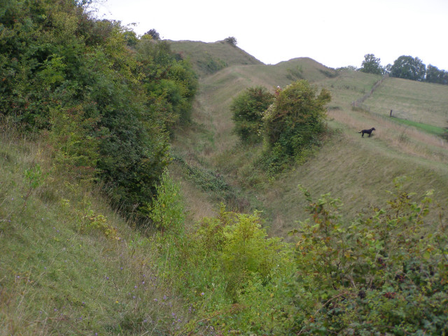
Northern side of the hillfort on Hod Hill
Looking along the northern side of the iron age hillfort, with the inner rampart on the left, the ditch in the middle and the outer rampart on the right (with the dog standing on it). The Roman second legion captured the hillfort in AD43 and built a smaller camp within the hillfort's northwest corner (the highest part of the hill, seen in the distance on the left).
 Map © Crown Copyright")
TIP: Click the map for more Large scale mapping
- Grid Square
- ST8510, 27 images (more nearby 🔍)
- Photographer
- Jim Champion (more nearby)
- Date Taken
- Sunday, 17 September, 2006 (more nearby)
- Submitted
- Monday, 18 September, 2006
- Subject Location
-
OSGB36:
 ST 855 108 [100m precision]
WGS84: 50:53.7897N 2:12.4529W - Camera Location
-
OSGB36: ST 858 108
- View Direction
- WEST (about 270 degrees)