2011
SK3075 : Upland farmland, Meek Fields
taken 13 years ago, near to Moorhall, Derbyshire, England
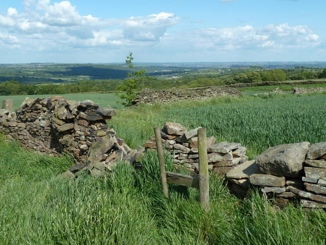
Upland farmland, Meek Fields
The treetops of Stripes Wood can be seen across the picture. The path cross the broken wall and follows the next wall heading to the right out of the picture.
 Map © Crown Copyright")
TIP: Click the map for more Large scale mapping
- Grid Square
- SK3075, 21 images (more nearby 🔍)
- Photographer
- Andrew Hill (more nearby)
- Date Taken
- Tuesday, 31 May, 2011 (more nearby)
- Submitted
- Friday, 3 June, 2011
- Subject Location
-
OSGB36:
 SK 3037 7521 [10m precision]
WGS84: 53:16.3807N 1:32.7634W - Camera Location
-
OSGB36: SK 3035 7520
- View Direction
- East-northeast (about 67 degrees)