2011
NS2985 : Path from Glen Fruin
taken 13 years ago, near to Inverlauren, Argyll And Bute, Scotland
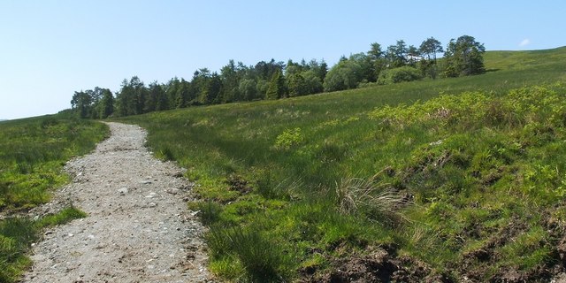
Path from Glen Fruin
The clump of trees visible ahead, beside the path, is indicated on the map, and is the same one as is shown, from the other side, in NS2985 : Highlandman's Wood - Glen Fruin track. They can also been seen in a photograph of NS3084 : Helensburgh, No 2 Reservoir, where they are visible on the left, part of the way down the distant hillside.
Further ahead, the path enters Drumfad Wood (NS2985 : The edge of Drumfad Wood); it leads eventually to Highlandman's Wood (NS2984 : Signpost in Highlandman's Wood).
Further ahead, the path enters Drumfad Wood (NS2985 : The edge of Drumfad Wood); it leads eventually to Highlandman's Wood (NS2984 : Signpost in Highlandman's Wood).
 Map © Crown Copyright")
TIP: Click the map for more Large scale mapping
- Grid Square
- NS2985, 21 images (more nearby 🔍)
- Photographer
- Lairich Rig (more nearby)
- Date Taken
- Friday, 3 June, 2011 (more nearby)
- Submitted
- Saturday, 11 June, 2011
- Subject Location
-
OSGB36:
 NS 2979 8540 [10m precision]
WGS84: 56:1.8697N 4:43.9931W - Camera Location
-
OSGB36: NS 2988 8555
- View Direction
- South-southwest (about 202 degrees)