2011
NY8043 : Bog at head of stream groove
taken 13 years ago, near to Coalcleugh, Northumberland, England
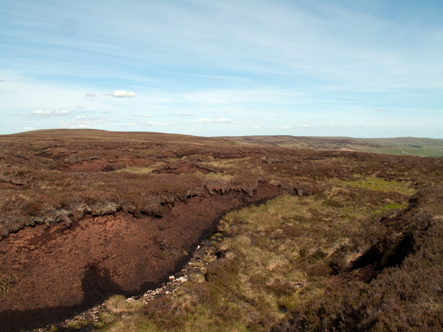
Bog at head of stream groove
West from Killhope Law (which is the heather dome at the left side of the image) a broad ridge extends where bogs and peat haggs abound. This is the head of one of the many peat lined gullies just on the south side of the watershed which carry water down to Killhope Beck and so the River Wear.
 Map © Crown Copyright")
TIP: Click the map for more Large scale mapping
- Grid Square
- NY8043, 38 images (more nearby 🔍)
- Photographer
- Trevor Littlewood (more nearby)
- Date Taken
- Tuesday, 14 June, 2011 (more nearby)
- Submitted
- Wednesday, 15 June, 2011
- Subject Location
-
OSGB36:
 NY 8042 4394 [10m precision]
WGS84: 54:47.3980N 2:18.3609W - Camera Location
-
OSGB36: NY 8037 4398
- View Direction
- Southeast (about 135 degrees)