2011
TR0816 : Track beside Dungeness Power Station
taken 13 years ago, 3 km from Lydd-on-Sea, Kent, England
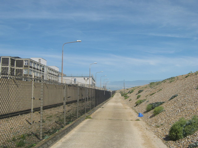
Track beside Dungeness Power Station
On the right is the high shingle bank beside the sea front.
Dungeness Power Station
Dungeness is a pair of nuclear power stations. Dungeness A was opened in 1965 and ceased in 2006. Dungeness B was opened in 1983, and is due to be decommissioned in 2018.
Wikipedia Link
 Map © Crown Copyright")
TIP: Click the map for more Large scale mapping
- Grid Square
- TR0816, 459 images (more nearby 🔍)
- Photographer
- David Anstiss (more nearby)
- Date Taken
- Tuesday, 14 June, 2011 (more nearby)
- Submitted
- Thursday, 16 June, 2011
- Subject Location
-
OSGB36:
 TR 0838 1662 [10m precision]
WGS84: 50:54.6852N 0:57.7700E - Camera Location
-
OSGB36: TR 0835 1661
- View Direction
- EAST (about 90 degrees)