2006
NT9025 : The Cheviot
taken 18 years ago, 3 km from Hethpool, Northumberland, England
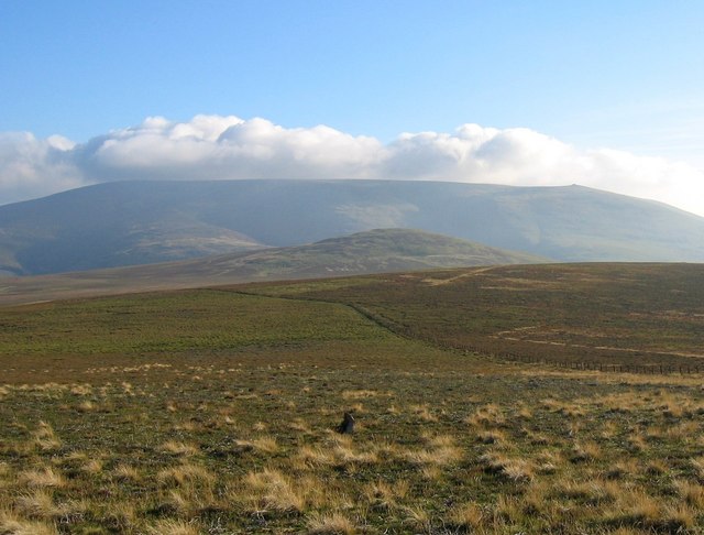
The Cheviot
Looking south over Coldburn Hill to The Cheviot. Within 20 minutes of taking this picture the cloud seen above Cheviot would engulf everything above 1000 foot.
 Map © Crown Copyright")
TIP: Click the map for more Large scale mapping
- Grid Square
- NT9025, 7 images (more nearby 🔍)
- Photographer
- Hill Walker (more nearby)
- Date Taken
- Saturday, 23 September, 2006 (more nearby)
- Submitted
- Sunday, 24 September, 2006
- Subject Location
-
OSGB36:
 NT 903 252 [100m precision]
WGS84: 55:31.2270N 2:9.3110W - Camera Location
-
OSGB36: NT 902 259
- View Direction
- SOUTH (about 180 degrees)