2011
SJ8746 : Trent and Mersey Canal by Hanley Cemetery, Stoke-on-Trent
taken 13 years ago, near to Stoke-on-Trent, England
This is 1 of 2 images, with title starting with Trent and Mersey Canal by Hanley Cemetery in this square
Trent and Mersey Canal by Hanley Cemetery, Stoke-on-Trent
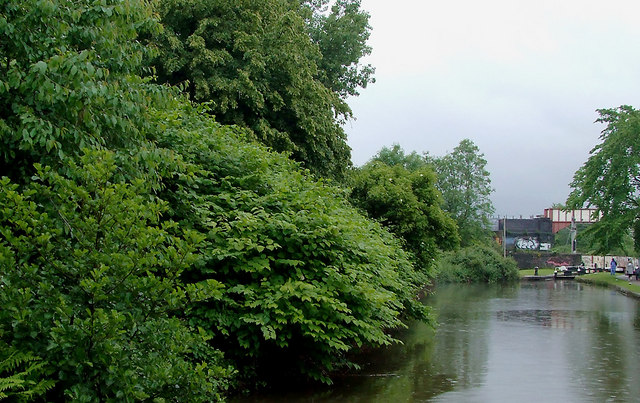
Dense undergrowth here includes a thriving intrusion of Japanese Knotweed. No action has been taken to eradicate this yet, though it has been here for some years. Cockshutts Lock (No 37) can be seen ahead, the fourth one down in the flight of five.
Cockshutts Lock No 37
The second lock up in the Stoke flight of five is listed as Cockshutts Lock (No 37) in the Nicholson's Canal Guides, but should this be Cockshutt Lock? Victorian maps show this as Cockshott Lock (by Cockshott Sidings). Other references now call it Cockshute Lock, or just Stoke Lock No 37.
Just saying. :-)
 Map © Crown Copyright")
TIP: Click the map for more Large scale mapping
- Grid Square
- SJ8746, 503 images (more nearby 🔍)
- Photographer
- Roger D Kidd (more nearby)
- Date Taken
- Monday, 30 May, 2011 (more nearby)
- Submitted
- Wednesday, 22 June, 2011
- Subject Location
-
OSGB36:
 SJ 874 461 [100m precision]
WGS84: 53:0.7589N 2:11.3514W - Camera Location
-
OSGB36: SJ 873 461
- View Direction
- Southeast (about 135 degrees)