NZ3769 : Tymemouth Castle
taken 13 years ago, near to Tynemouth, North Tyneside, England
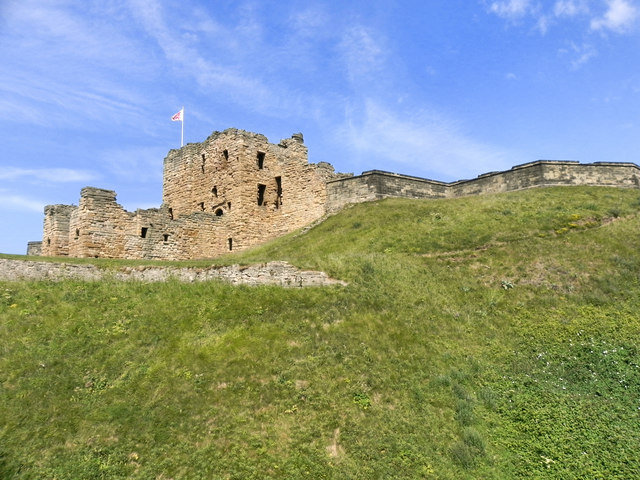
Tynemouth Castle and Priory, located on a rocky headland of Pen Bal Crag, overlooking the North Sea and the River Tyne, was once one of the largest fortified areas in England.
The moated castle-towers, gatehouse and keep are combined with the ruins of the Benedictine priory where early kings of Northumbria were buried.
A monastery lay on this headland by the mid 7th Century and following plunder by the Danes in the ninth century the headland was fortified by Tostig, Earl of Northumberland. In 1296 Edward I granted the prior and convent a formal licence to crenellate (Link) and it was considered by Edward III to be one of the strongest fortresses of the Marches.
Much of the castle was demolished in 1665 by the then Governor, Colonel Edward Villiers, to build a new barracks, a lighthouse and a house for himself. By 1681 the castle had decayed and only had a slender garrison. It remained manned until the 20th century when it was handed over from the War Office for preservation.
More recently the site has hosted the modern buildings of Her Majesty's Coastguard. However the new coastguard station, built in 1980 and opened by Prince Charles, was closed in 2001.
Link
Link
 Map © Crown Copyright")
- Grid Square
- NZ3769, 570 images (more nearby 🔍)
- Photographer
- David Dixon (more nearby)
- Date Taken
- Monday, 20 June, 2011 (more nearby)
- Submitted
- Monday, 27 June, 2011
- Subject Location
-
OSGB36:
 NZ 3721 6935 [10m precision]
WGS84: 55:1.0387N 1:25.1763W - Camera Location
-
OSGB36: NZ 3720 6925
- View Direction
- NORTH (about 0 degrees)