2011
SJ9048 : Caldon Canal south of Milton, Stoke-on-Trent
taken 13 years ago, near to Milton, Stoke-on-Trent, England
This is 1 of 2 images, with title Caldon Canal south of Milton, Stoke-on-Trent in this square
Caldon Canal south of Milton, Stoke-on-Trent
The River Trent meanders northwards through scrub and grass land about fifty metres off to the right.
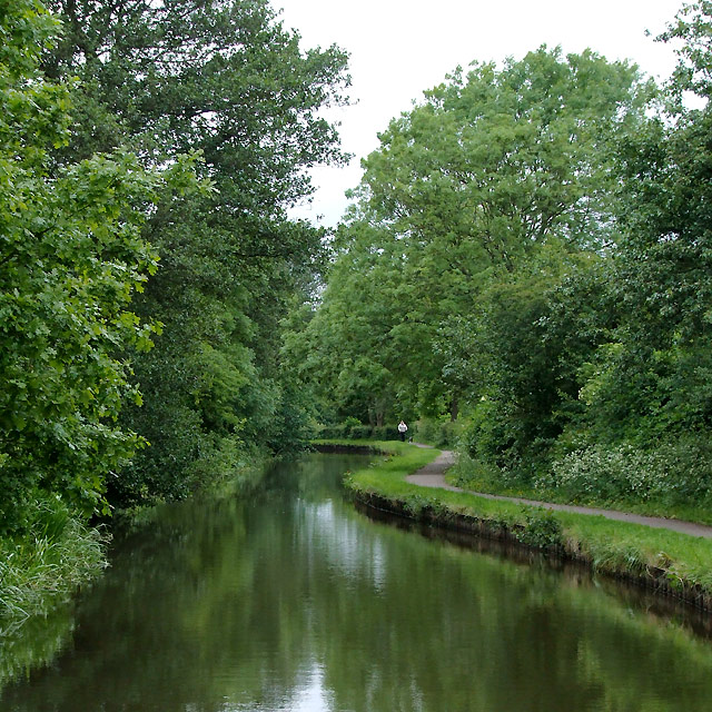
The Caldon Branch of the Trent and Mersey Canal opened in 1779. It runs eighteen miles from Etruria in Stoke-on-Trent, where it leaves the Trent and Mersey Canal. It terminates at Froghall about five miles south-east of Cheddleton. The canal has seventeen locks and the 69 metre long very low Froghall Tunnel, unusable by many narrowboats. The canal did originally continue through to Uttoxeter, but the section beyond Froghall was closed by the late 1840s, much of its course being filled in to construct a railway.
The Caldon Branch of the Trent and Mersey Canal opened in 1779. It runs eighteen miles from Etruria in Stoke-on-Trent, where it leaves the Trent and Mersey Canal. It terminates at Froghall about five miles south-east of Cheddleton. The canal has seventeen locks and the 69 metre long very low Froghall Tunnel, unusable by many narrowboats. The canal did originally continue through to Uttoxeter, but the section beyond Froghall was closed by the late 1840s, much of its course being filled in to construct a railway.
 Map © Crown Copyright")
TIP: Click the map for more Large scale mapping
- Grid Square
- SJ9048, 48 images (more nearby 🔍)
- Photographer
- Roger D Kidd (more nearby)
- Date Taken
- Friday, 27 May, 2011 (more nearby)
- Submitted
- Friday, 1 July, 2011
- Subject Location
-
OSGB36:
 SJ 901 488 [100m precision]
WGS84: 53:2.2187N 2:8.8667W - Camera Location
-
OSGB36: SJ 902 488
- View Direction
- North-northwest (about 337 degrees)