2011
NS5181 : Quinlochmore
taken 13 years ago, near to Dumgoyne, Stirling, Scotland
This is 1 of 2 images, with title Quinlochmore in this square
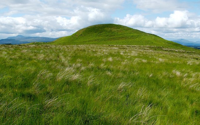
Quinlochmore
The hill is located on Quinloch Muir, and is called Quinlochmore. For a discussion of earlier forms of the name Quinloch, see NS4982 : Summit of Little Caldon Hill.
The remains of a fort can be seen on the summit of the hill: NS5181 : Summit of Quinlochmore.
In addition, a linear feature can be seen running along the near side of the hill; it leads from the foot of the left-hand side of the hill to a point higher up on the right-hand side. That feature is simply the northern side of a large enclosure, which is indicated by a dotted line on the 1:25000 OS map (the enclosure is not related to the fort, and is just part of a field system of recent centuries). The enclosure as a whole is best appreciated from the southern edge of the summit of the hill: NS5181 : Enclosure beside Quinlochmore.
 Map © Crown Copyright")
TIP: Click the map for more Large scale mapping
- Grid Square
- NS5181, 20 images (more nearby 🔍)
- Photographer
- Lairich Rig (more nearby)
- Date Taken
- Thursday, 30 June, 2011 (more nearby)
- Submitted
- Saturday, 9 July, 2011
- Subject Location
-
OSGB36:
 NS 5150 8133 [10m precision]
WGS84: 56:0.1110N 4:22.9749W - Camera Location
-
OSGB36: NS 5155 8111
- View Direction
- North-northwest (about 337 degrees)