2011
TA2318 : Boat in Stone Creek, East Yorks
taken 13 years ago, 3 km from Sunk Island, East Riding of Yorkshire, England
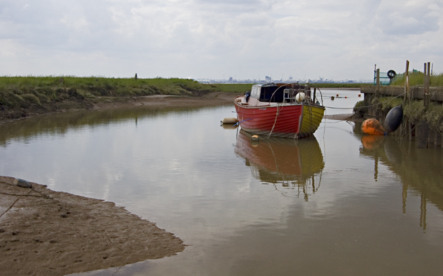
Boat in Stone Creek, East Yorks
Showing the smaller, eastern inlet at the creek on the north bank of the Humber estuary. Its name refers to the stones which were brought through the port for use in churches at Patrington and elsewhere in Holderness. The creek's importance grew following the silting up of the former port at Patrington Haven in the mid-19th century. Fishermen worked out of the Creek until the 1950s. Today it is home to the Stone Creek Boat Club. The port of Immingham is visible on the horizon.
 Map © Crown Copyright")
TIP: Click the map for more Large scale mapping
- Grid Square
- TA2318, 84 images (more nearby 🔍)
- Photographer
- Paul Harrop (more nearby)
- Date Taken
- Monday, 11 July, 2011 (more nearby)
- Submitted
- Monday, 11 July, 2011
- Subject Location
-
OSGB36:
 TA 23647 18823 [1m precision]
WGS84: 53:39.0780N 0:7.8430W - Camera Location
-
OSGB36: TA 23670 18845
- View Direction
- Southwest (about 225 degrees)