2006
NM5761 : "The Ruin" Ardslignish
taken 18 years ago, near to Ardslignish, Highland, Scotland
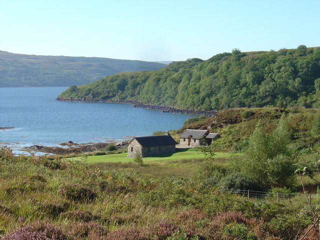
"The Ruin" Ardslignish
An example of the reversal of the clearances in operation with ruined crofts being brought back to life as tourist accommodation.
 Map © Crown Copyright")
TIP: Click the map for more Large scale mapping
- Grid Square
- NM5761, 14 images (more nearby 🔍)
- Photographer
- Ian Lavender (more nearby)
- Date Taken
- Saturday, 16 September, 2006 (more nearby)
- Submitted
- Saturday, 30 September, 2006
- Subject Location
-
OSGB36:
 NM 572 615 [100m precision]
WGS84: 56:40.9187N 5:57.9513W - Camera Location
-
OSGB36: NM 572 616
- View Direction
- South-southwest (about 202 degrees)