2011
TQ1379 : Grand Junction Canal weight sign
taken 13 years ago, near to Norwood Green, Ealing, England
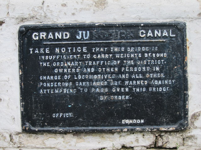
Grand Junction Canal weight sign
Seen on TQ1379 : Bridge 204
The Grand Junction now forms the southern half of the Grand Union canal.
The Grand Junction now forms the southern half of the Grand Union canal.
The Grand Union Canal
The Grand Union is a 137 mile (220km), 166 lock, 2 tunnel canal running between Brentford in London and Birmingham. It is the longest canal in Britain, and has 11 main arms and junctions. It takes over a week to navigate.
The Leicester arm branches off at Norton Junction and runs 66 miles long through 59 locks (including 2 staircase locks at Foxton) and 2 tunnels to Leicester where it continues into the River Soar.
Read more at Wikipedia Link
 Map © Crown Copyright")
TIP: Click the map for more Large scale mapping
- Grid Square
- TQ1379, 199 images (more nearby 🔍)
- Photographer
- Oast House Archive (more nearby)
- Date Taken
- Thursday, 14 July, 2011 (more nearby)
- Submitted
- Monday, 18 July, 2011
- Subject Location
-
OSGB36:
 TQ 137 793 [100m precision]
WGS84: 51:30.1103N 0:21.7892W - Camera Location
-
OSGB36: TQ 137 793
- View Direction
- East-northeast (about 67 degrees)