2011
SW9451 : Green Lane
taken 13 years ago, near to Coombe, Cornwall, England
Green Lane
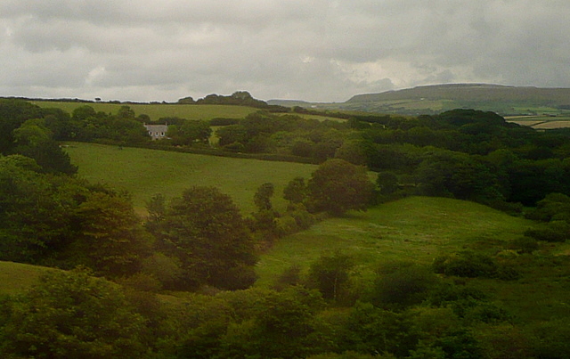
This view from the Resugga railway viaduct west of Coombe shows how green the area is. Lots of pastures and woodland, but with the China Clay areas of St Austell on the horizon.
This photo was taken from the 1158 Penzance to London Paddington train, having left Truro at 1244.
This photo was taken from the 1158 Penzance to London Paddington train, having left Truro at 1244.
 Map © Crown Copyright")
TIP: Click the map for more Large scale mapping
- Grid Square
- SW9451, 20 images (more nearby 🔍)
- Photographer
- Graham Horn (more nearby)
- Date Taken
- Saturday, 9 July, 2011 (more nearby)
- Submitted
- Saturday, 23 July, 2011
- Subject Location
-
OSGB36:
 SW 947 515 [100m precision]
WGS84: 50:19.6548N 4:53.1463W - Camera Location
-
OSGB36: SW 9443 5113
- View Direction
- Northeast (about 45 degrees)