2011
SE0025 : Hebden Royd Footpath 50, eastern branch, Mytholmroyd
taken 13 years ago, near to Mytholmroyd, Calderdale, England
This is 1 of 4 images, with title Hebden Royd Footpath 50, eastern branch, Mytholmroyd in this square
Hebden Royd Footpath 50, eastern branch, Mytholmroyd
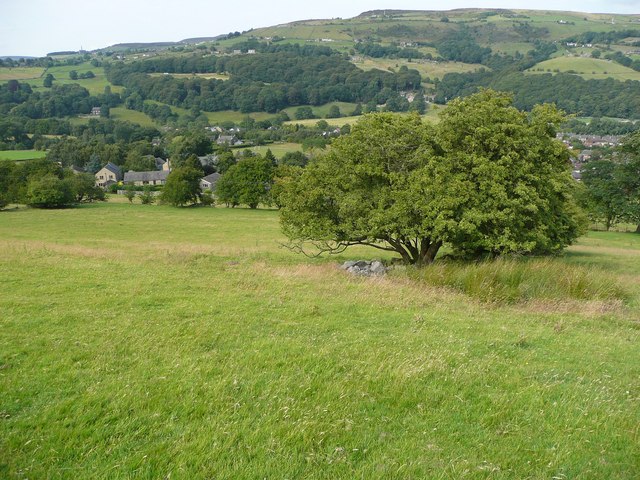
The right-of-way passes the pile of stones and tree, which mark the corner of what was a separate field.
 Map © Crown Copyright")
TIP: Click the map for more Large scale mapping
- Grid Square
- SE0025, 262 images (more nearby 🔍)
- Photographer
- Humphrey Bolton (more nearby)
- Date Taken
- Thursday, 28 July, 2011 (more nearby)
- Submitted
- Friday, 29 July, 2011
- Subject Location
-
OSGB36:
 SE 004 257 [100m precision]
WGS84: 53:43.6620N 1:59.7249W - Camera Location
-
OSGB36: SE 004 257
- View Direction
- North-northeast (about 22 degrees)