2011
NZ2742 : Elvet Bridge, Durham
taken 13 years ago, near to Durham, County Durham, England
This is 1 of 11 images, with title Elvet Bridge, Durham in this square
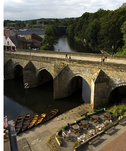
Elvet Bridge, Durham
Seen from the Prince Bishops car park. The bridge links the peninsula to the Elvet area of the city, and is a Grade I listed building. It was constructed in 1160 and has a total of 10 arches. The number 2 is for the guidance of the many rowers who use the river - denoting the 'hard' arch for rowers; number 1 is the 'easy' arch.
 Map © Crown Copyright")
TIP: Click the map for more Large scale mapping
- Grid Square
- NZ2742, 1480 images (more nearby 🔍)
- Photographer
- Paul Harrop (more nearby)
- Date Taken
- Saturday, 30 July, 2011 (more nearby)
- Submitted
- Sunday, 31 July, 2011
- Subject Location
-
OSGB36:
 NZ 27544 42426 [1m precision]
WGS84: 54:46.5599N 1:34.3998W - Camera Location
-
OSGB36: NZ 27538 42463
- View Direction
- SOUTH (about 180 degrees)