2010
NH9951 : Warning Sign on Dunearn Burn Walk
taken 13 years ago, near to Logie, Moray, Scotland
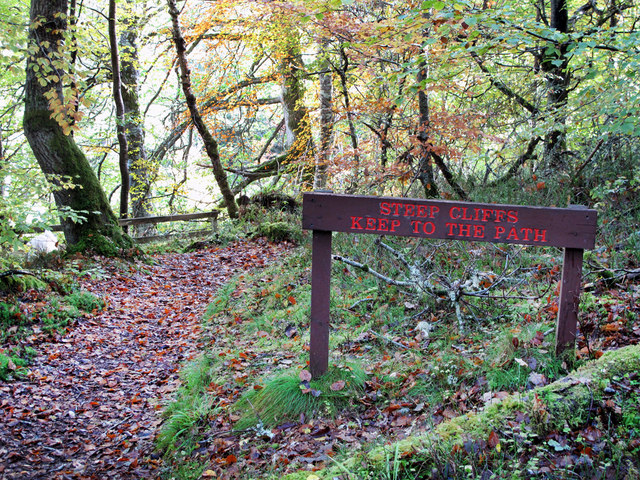
Warning Sign on Dunearn Burn Walk
The Dunearn Burn Walk takes you along the cliff edge of the River Findhorn. The track is muddy and steep in places.
 Map © Crown Copyright")
TIP: Click the map for more Large scale mapping
- Grid Square
- NH9951, 13 images (more nearby 🔍)
- Photographer
- Jean Aldridge (more nearby)
- Date Taken
- Saturday, 23 October, 2010 (more nearby)
- Submitted
- Tuesday, 2 August, 2011
- Subject Location
-
OSGB36:
 NH 9997 5163 [10m precision]
WGS84: 57:32.6214N 3:40.3676W - Camera Location
-
OSGB36: NH 9995 5163
- View Direction
- EAST (about 90 degrees)