2011
SK2163 : Overlooking Mawstone Farm and Youlgreave
taken 13 years ago, near to Youlgreave, Derbyshire, England
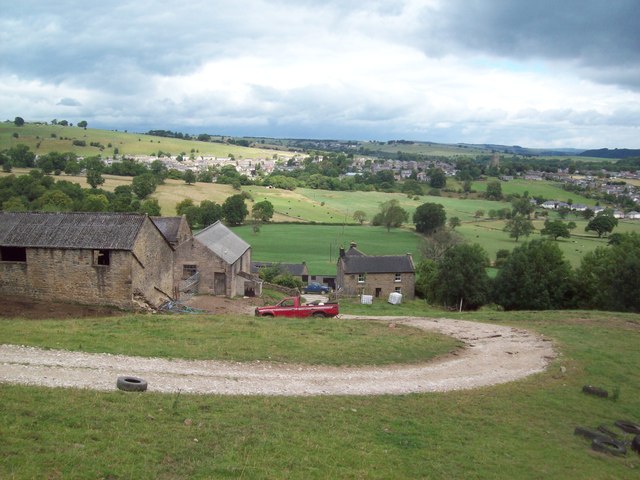
Overlooking Mawstone Farm and Youlgreave
Footpath descending from Harthill Moor towards the River Bradford. Mawstone Farm is in the foreground with Youlgreave (situated in SK2064 and SK2164) beyond.
 Map © Crown Copyright")
TIP: Click the map for more Large scale mapping
- Grid Square
- SK2163, 74 images (more nearby 🔍)
- Photographer
- Jonathan Clitheroe (more nearby)
- Date Taken
- Sunday, 7 August, 2011 (more nearby)
- Submitted
- Sunday, 7 August, 2011
- Subject Location
-
OSGB36:
 SK 2108 6328 [10m precision]
WGS84: 53:9.9735N 1:41.1686W - Camera Location
-
OSGB36: SK 2108 6322
- View Direction
- NORTH (about 0 degrees)