2011
SS9084 : Old railway abutments near Brynmenyn
taken 13 years ago, near to Brynmenyn, Bridgend/Pen-y-Bont ar Ogwr, Wales
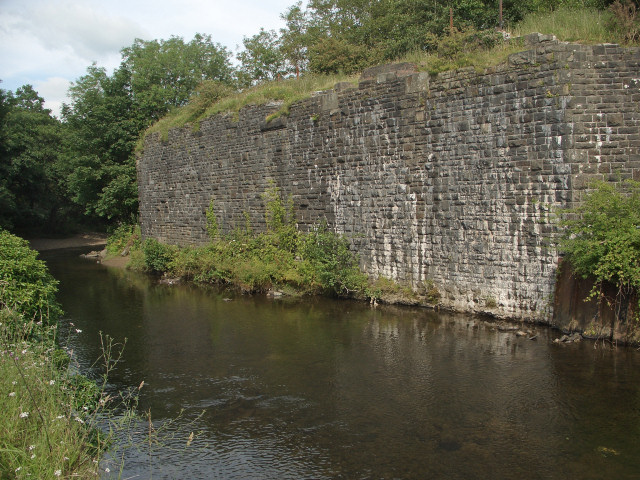
Old railway abutments near Brynmenyn
Substantial abutments on the east bank of the River Ogmore just to the south of Brynmenyn. Old maps indicate that they were situated near the north-western end of the G.W.R. Pencoed Branch. The maps indicate also that two sides of a railway triangle crossed The Ogmore in the immediate area, converging just to the east of the river, although it is unclear whether the abutments seen supported both.
 Map © Crown Copyright")
TIP: Click the map for more Large scale mapping
- Grid Square
- SS9084, 102 images (more nearby 🔍)
- Photographer
- eswales (more nearby)
- Date Taken
- Friday, 5 August, 2011 (more nearby)
- Submitted
- Tuesday, 9 August, 2011
- Subject Location
-
OSGB36:
 SS 904 844 [100m precision]
WGS84: 51:32.8904N 3:34.9212W - Camera Location
-
OSGB36: SS 903 844
- View Direction
- East-northeast (about 67 degrees)