2011
NO4499 : Loch Kinord Crannog
taken 13 years ago, near to Dinnet, Aberdeenshire, Scotland
This is 1 of 3 images, with title Loch Kinord Crannog in this square
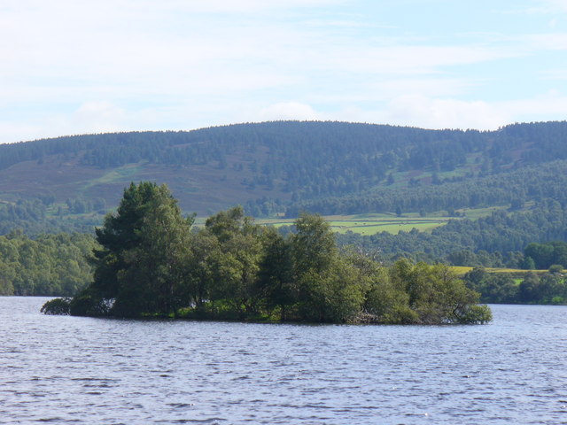
Loch Kinord Crannog
Islet in Loch Kinord which was once a defensible habitation. A hut was built here on a platform.
Link
Link
 Map © Crown Copyright")
TIP: Click the map for more Large scale mapping
- Grid Square
- NO4499, 66 images (more nearby 🔍)
- Photographer
- Colin Smith (more nearby)
- Date Taken
- Wednesday, 3 August, 2011 (more nearby)
- Submitted
- Tuesday, 9 August, 2011
- Subject Location
-
OSGB36:
 NO 4434 9952 [10m precision]
WGS84: 57:4.9982N 2:55.1952W - Camera Location
-
OSGB36: NO 4427 9969
- View Direction
- South-southeast (about 157 degrees)