2011
SD7471 : The channel of Know Gap Sike
taken 13 years ago, near to Clapham, North Yorkshire, England
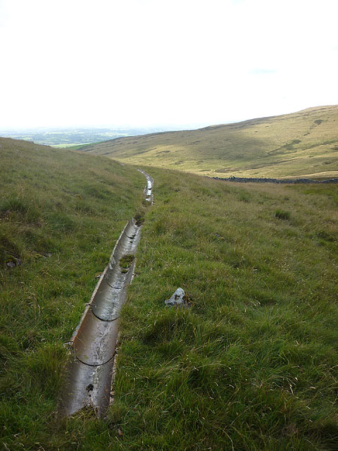
The channel of Know Gap Sike
The channel is an artificial watercourse constructed to carry a water supply from the peat moorland of Hurnel Moss across the permeable limestone to Clapdale Farm. It seems to have been allowed to fall into disrepair. Grey Wife Sike to the west across Cote Gill was a similar artificial watercourse.
 Map © Crown Copyright")
TIP: Click the map for more Large scale mapping
- Grid Square
- SD7471, 17 images (more nearby 🔍)
- Photographer
- Karl and Ali (more nearby)
- Date Taken
- Sunday, 7 August, 2011 (more nearby)
- Submitted
- Wednesday, 10 August, 2011
- Subject Location
-
OSGB36:
 SD 7410 7102 [10m precision]
WGS84: 54:8.0620N 2:23.8730W - Camera Location
-
OSGB36: SD 7412 7102
- View Direction
- WEST (about 270 degrees)