2011
ST1688 : Riverbank field, Bedwas
taken 13 years ago, near to Bedwas, Caerphilly/Caerffili, Wales
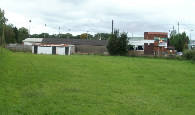
Riverbank field, Bedwas
Viewed from near the corner of Bedwas Road and Old Bedwas Road. The field is on the north bank of the River Rhymney. Behind the field is the eastern edge of Bridge Field, the home ground of Bedwas RFC (rugby football club).
 Map © Crown Copyright")
TIP: Click the map for more Large scale mapping
- Grid Square
- ST1688, 161 images (more nearby 🔍)
- Photographer
- Jaggery (more nearby)
- Date Taken
- Saturday, 13 August, 2011 (more nearby)
- Submitted
- Saturday, 13 August, 2011
- Subject Location
-
OSGB36:
 ST 169 884 [100m precision]
WGS84: 51:35.2981N 3:12.0532W - Camera Location
-
OSGB36: ST 169 884
- View Direction
- WEST (about 270 degrees)