2011
TR2538 : Cliff top view of Folkestone Warren at Capel-le-Ferne
taken 13 years ago, near to Capel-le-Ferne, Kent, England
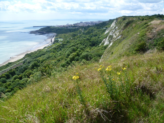
Cliff top view of Folkestone Warren at Capel-le-Ferne
This photograph is taken looking along the cliffs between the Battle of Britain Memorial and the Cliff Top Cafe at Capel-le-Ferne. Both the North Downs Way and the Saxon Shore Way follow the cliff top and give dramatic views of the chalk cliffs and of Folkestone Warren with the railway line at the bottom. In the distance is Folkestone Harbour.
 Map © Crown Copyright")
TIP: Click the map for more Large scale mapping
- Grid Square
- TR2538, 137 images (more nearby 🔍)
- Photographer
- Marathon (more nearby)
- Date Taken
- Monday, 8 August, 2011 (more nearby)
- Submitted
- Saturday, 13 August, 2011
- Subject Location
-
OSGB36:
 TR 2513 3833 [10m precision]
WGS84: 51:6.0030N 1:12.8504E - Camera Location
-
OSGB36: TR 2523 3839
- View Direction
- West-southwest (about 247 degrees)