2011
HU2253 : Walls: Burn of Cattikismires enters Burga Water
taken 13 years ago, 4 km SW of West Burrafirth, Mainland, Shetland Islands, Scotland
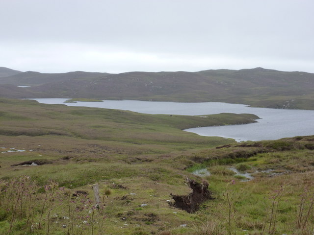
Walls: Burn of Cattikismires enters Burga Water
Looking just east of north from the A971 - the burn can just be seen entering the loch at the 'bottom' of the loch as we look at it. Only a small part of this square accounts for Burga Water; the next square northeast HU2354 contains the majority, including the two small islands in the distance.
 Map © Crown Copyright")
TIP: Click the map for more Large scale mapping
- Grid Square
- HU2253, 16 images (more nearby 🔍)
- Photographer
- Chris Downer (more nearby)
- Date Taken
- Saturday, 6 August, 2011 (more nearby)
- Submitted
- Sunday, 14 August, 2011
- Subject Location
-
OSGB36:
 HU 2290 5389 [10m precision]
WGS84: 60:16.1150N 1:35.2743W - Camera Location
-
OSGB36: HU 2276 5363
- View Direction
- North-northeast (about 22 degrees)