2011
J3872 : Petrol station, Knock, Belfast (2)
taken 13 years ago, 4 km WSW of Dundonald, Co Down, Northern Ireland
Petrol station, Knock, Belfast (2)
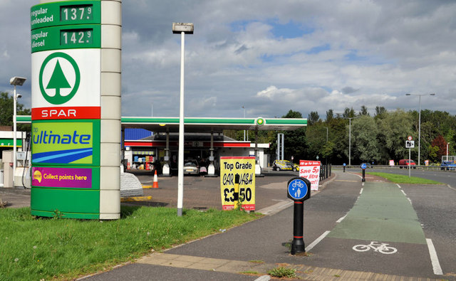
A petrol station, beside the inward carriageway of the Knock Road, for which there was (in April 2011) an application for planning permission 0485/F 211 Knock Road , Belfast Demolition of existing development and erection of replacement facility involving convenience store, petrol forecourt, jet wash and drive through car wash. Note added on 25 August 2012 now demolished. J3872 : New petrol station, Knock, Belfast shows the replacement under construction in November 2012.
Loading map... (JavaScript required)
- Grid Square
- J3872, 21 images (more nearby 🔍)
- Photographer
- Albert Bridge (more nearby)
- Date Taken
- Monday, 15 August, 2011 (more nearby)
- Submitted
- Monday, 15 August, 2011
- Subject Location
-
Irish:
 J 380 725 [100m precision]
WGS84: 54:34.9258N 5:51.9433W - Camera Location
-
Irish: J 380 724
- View Direction
- North-northeast (about 22 degrees)